1. Check risk first
Start on Convective Outlook to see whether severe storms are expected.
Use this page to understand what national forecast maps mean, what to watch for, and what action to take. You should not need technical terms to use this guide.
Start on Convective Outlook to see whether severe storms are expected.
Use forecast maps to see when rain, wind, heat, or cold is most likely in your region.
Return to Weather Alerts to see active warnings and watches for your state.
Charge devices, review your safe place, and avoid risky travel windows if possible.
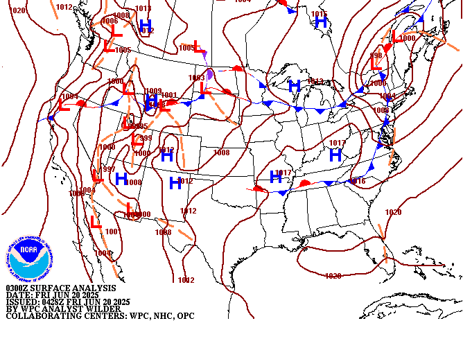
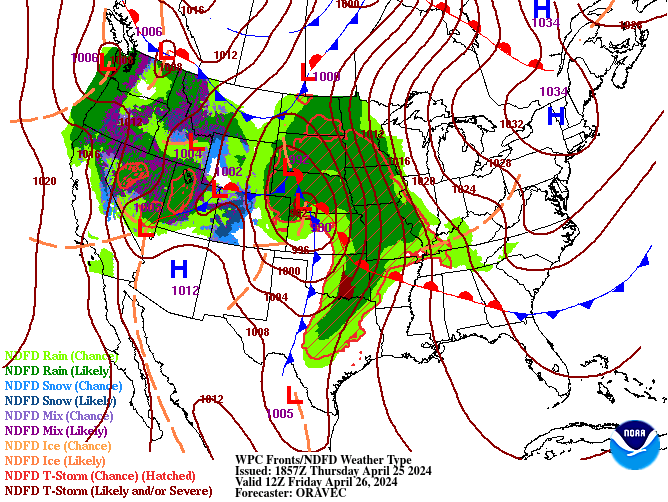
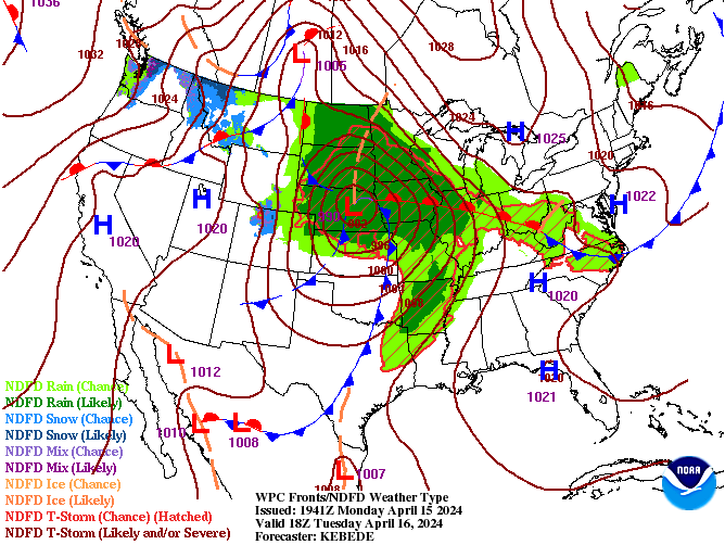
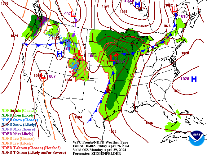
These maps are pulled from official NWS/WPC sources and update regularly. If a map does not load, use the official link under it.


Use it for: heat and cold planning.
Quick read: if your area is much warmer or colder than normal, prepare clothing, hydration, and home heating/cooling plans.
Act when: dangerous heat or cold overlaps outdoor work, school, sports, or travel.
Open official temperature mapUse it for: high-profile vehicle travel, boating, and wildfire spread conditions.
Quick read: stronger winds and shifting wind direction increase impact and uncertainty.
Act when: strong wind lines up with storms, dry air, or vulnerable travel plans.
Open official wind mapUse it for: rain or snow likelihood.
Quick read: higher values mean weather is more likely, not necessarily more intense.
Act when: high chances overlap commute, events, or flood-prone locations.
Open official precipitation chance mapUse it for: flood concern and drainage impact.
Quick read: larger totals can cause standing water, ponding, and flash flood risk in sensitive areas.
Act when: heavy totals are expected on already wet ground.
Open official precipitation amount mapUse it for: next 1 to 3 days.
Quick read: best for near-term travel, events, and staffing decisions.
Act when: hazards are expected during your exact activity window.
Open official short range mapsUse it for: day 3 to day 7 planning.
Quick read: use for trend awareness, then refine decisions closer to event time.
Act when: multiple map types point to the same risk pattern.
Open official medium range mapsIf all three line up, move to action mode. Do not wait for perfect certainty.
Use at least temperature, wind, and precipitation together before making plans.
As the event gets closer, trust the most recent updates over older map snapshots.
PoP: Probability of precipitation in a time window.
QPF: Quantitative precipitation forecast (how much liquid precipitation may fall).
NDFD: National Digital Forecast Database, used in many official forecast map products.
WPC: Weather Prediction Center, producer of national map products and forecast discussions.